
THE UNKNOWN QUEST IN-DEPTH INVESTIGATION
What Is Hiding Beneath Mount Zeil?
A Cold War remote viewer, four mysterious mountains and Australia’s strangest unfinished quest
Deep in Central Australia, one mountain keeps turning up in places it should not: psychic intelligence files, military experiments, UFO stories, satellite-image mysteries and ancient accounts of a landscape shaped by travelling beings. Nobody has proved what lies beneath it. Almost nobody has seriously looked.
It could be said that Mount Zeil has two lives.
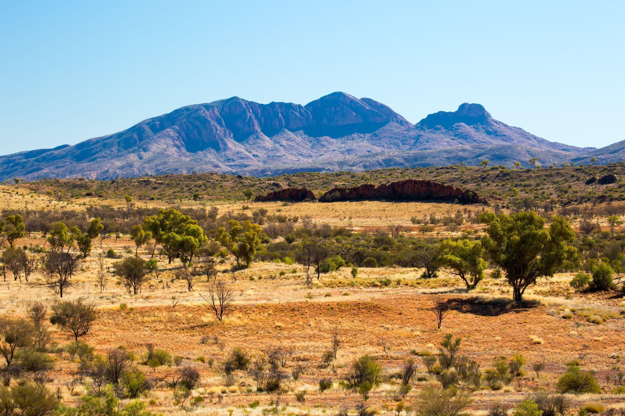
By daylight, it is Urlatherrke: a vast red-grey mountain rising from the western MacDonnell Ranges, 1,531 metres above sea level and higher than anything else in the Northern Territory. It is remote, culturally significant and difficult enough to reach that most Australians will never see it except on a screen. [7–8, 21]
Its second life begins underground. In that version, the mountain is not merely rock. It is an arrival point; a hidden facility through which non-human visitors enter, rest and move between a network of bases scattered across the planet.
That sounds like the sort of story invented in a late-night internet forum. It was not. The modern claim can be traced back to 1973, to a Cold War remote viewer named Pat Price and a 47-page dossier he handed to physicist Hal Puthoff. According to Atwater’s archive, almost a decade later he quietly tasked other remote viewers within the Army programme with the same coordinates without telling them what Price had reported. [1–3]
What they described is where the adventure really starts.
LAND / CULTURE / SECRECY
Before Mount Zeil, there was Urlatherrke
The Western name dates to explorer Ernest Giles’s 1872 expedition; the mountain’s physical structure is far older. Mount Zeil is formed by the Mount Zeil Granite, an ancient granitic body shaped by deformation, faulting and erosion. Long before anyone called it Mount Zeil, Urlatherrke already belonged to a much larger story written across the land. [34, 36]
Public Arrernte accounts tell of ancestral caterpillar beings whose journeys shaped the country around Mparntwe / Alice Springs. Groups travelled from several directions, including Urlatherrke in the west, before converging at Mparntwe. The long ridges of the MacDonnell Ranges preserve their movement: bodies joined head to tail across the landscape. [7–8]
Publicly available Arrernte accounts do not explicitly describe the modern claim of an extraterrestrial facility beneath Mount Zeil. But these accounts belong to a living knowledge tradition, parts of which remain private. Outsiders therefore cannot honestly declare the two stories connected or rule out connections contained within knowledge that has not been shared. What the public record does establish is that, long before Price and the intelligence files, Urlatherrke was already understood as a place of movement, convergence and profound significance. The modern mystery did not arrive on an empty map. [7–8, 35]
Modern secrecy entered the landscape much later. Near Alice Springs, Pine Gap grew into a real joint Australian–United States intelligence and missile-warning facility that was publicly described for years as a ‘space research’ facility despite its intelligence role. It is not Mount Zeil, and it does not explain Price’s claim. But it places his chosen Australian target in a region where advanced surveillance, restricted information and American intelligence interests already met. [30]
Then, in 1973, Pat Price placed Urlatherrke on a third map: a four-site network that he believed stretched around the planet.
1973 / PAT PRICE
The man who found four mountains
Pat Price was a former California police commissioner and city councilman, and one of the most celebrated remote viewers to work with Stanford Research Institute’s early psychic research programme. Remote viewing was the attempt to describe a distant or hidden target using the mind alone. During the Cold War, when intelligence agencies were searching for any advantage over their rivals, reports suggested the Soviet Union was conducting psychic research of its own. The possibility carried obvious strategic appeal. A successful viewer might be able to view experiments, describe restricted installations and report on secret military activity without ever leaving the room.
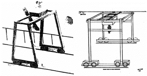
Price’s reputation was built on the remarkable specificity of his strongest sessions. Programme records credited him with describing a sensitive West Virginia installation and producing classified code words associated with its operations. At the Soviet URDF-3 target, he sketched a large rail-mounted gantry crane that analysts regarded as a notable correspondence, although the same technical review judged the experiment unsuccessful overall. The specificity of his strongest results nevertheless made Price a central figure in remote-viewing history. This was the record he carried into his 1973 account of four hidden sites around the world. The account that would eventually bring Mount Zeil into the story. [1, 10, 27]
The programme that became Stargate
Today this long-running experiment is usually remembered by its final and most cinematic name: Project Stargate. In 1973, however, Price’s work belonged to an earlier CIA-funded phase at Stanford Research Institute known as SCANATE. As agencies, sponsors and units changed, related work travelled through a procession of names: Grill Flame, Center Lane, Sun Streak and eventually Stargate. The labels changed more often than a spy in a cheap novel; the central question did not. Could trained people obtain useful information about a distant or hidden target without reaching it through the ordinary senses? [20, 31]
In 1973, Price arrived with something nobody had asked him to produce: 47 pages describing four underground facilities that he believed were operated by non-human beings. They were hidden beneath mountains in Alaska, Spain, Zimbabwe and Australia. Each had a different job. Together, they formed a system. [1–2]
 ARCHIVE IMAGE: 05-esp-cards.png
HANDWRITTEN / PRINTED COORDINATES
Four mountains.
Four alleged roles.
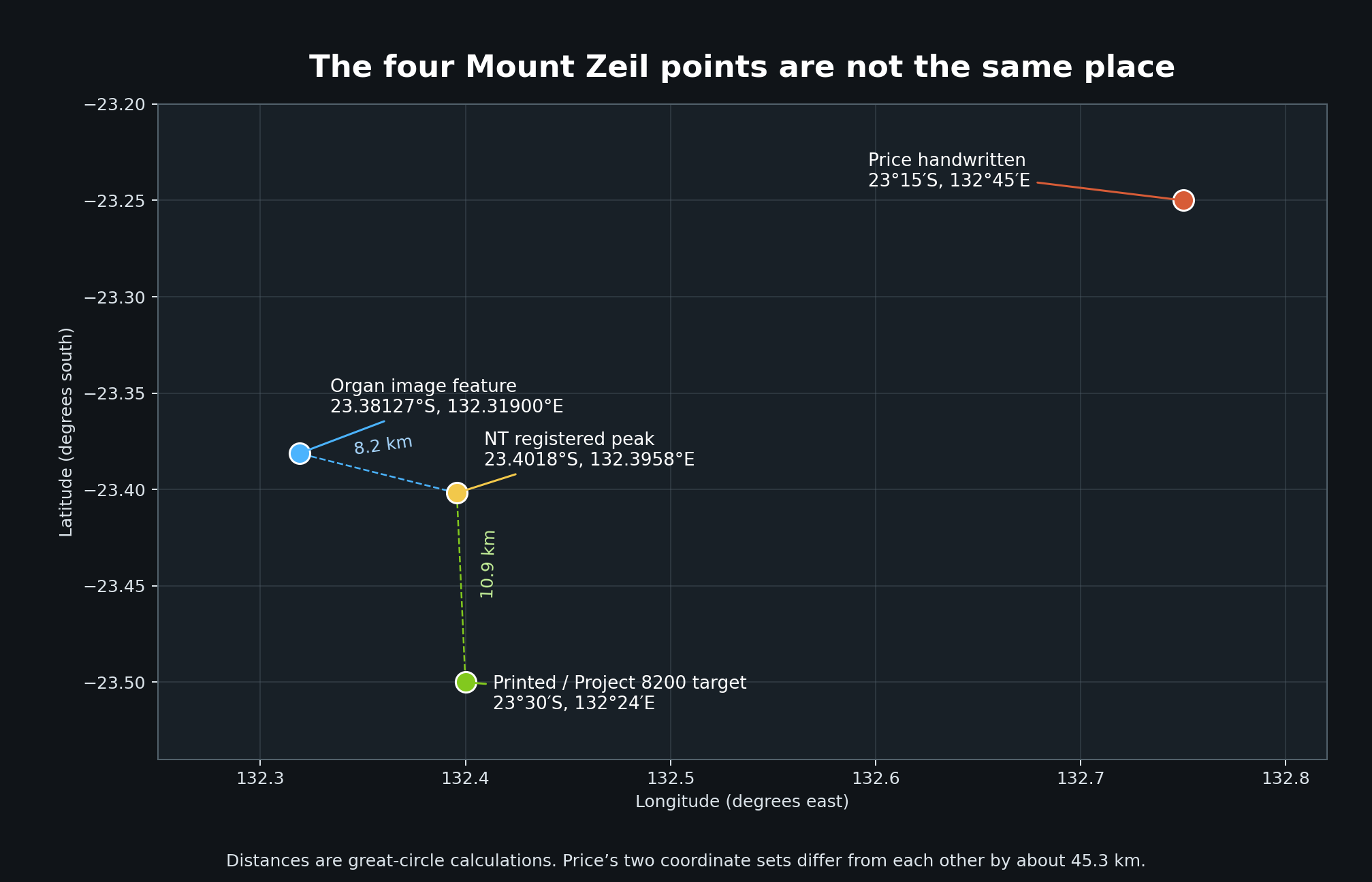
Top line: Price’s handwritten coordinates. Bottom line: the regularised figures printed with the 2024 facsimile. The two sets do not always match; at Mount Zeil they identify points approximately 45.3 kilometres apart. [1]
| Mountain | Coordinates | Role | What Price reported |
|---|---|---|---|
| Mount Hayes, Alaska | 63°32′N, 146°40′W / 63°39′N, 146°45′W | Watch | Weather and geological monitoring |
| Mount Perdido, Pyrenees | 42°40′N, 0°00′ / 42°40′N, 0°02′E | Launch | Protected launch-and-recovery site |
| Mount Nyangani, Zimbabwe | 18°06′S, 32°37′E / 18°18′S, 32°54′E | Repair | Equipment and vehicle maintenance |
| Mount Zeil, Australia | 23°15′S, 132°45′E / 23°30′S, 132°24′E | Arrive | Personnel centre and entry point |
 PRIMARY SOURCE: 06-price-papers.png
THE PERSONNEL CENTER
Mount Zeil: the front door
 ARCHIVE IMAGE: 04-pat-price-crane.gif
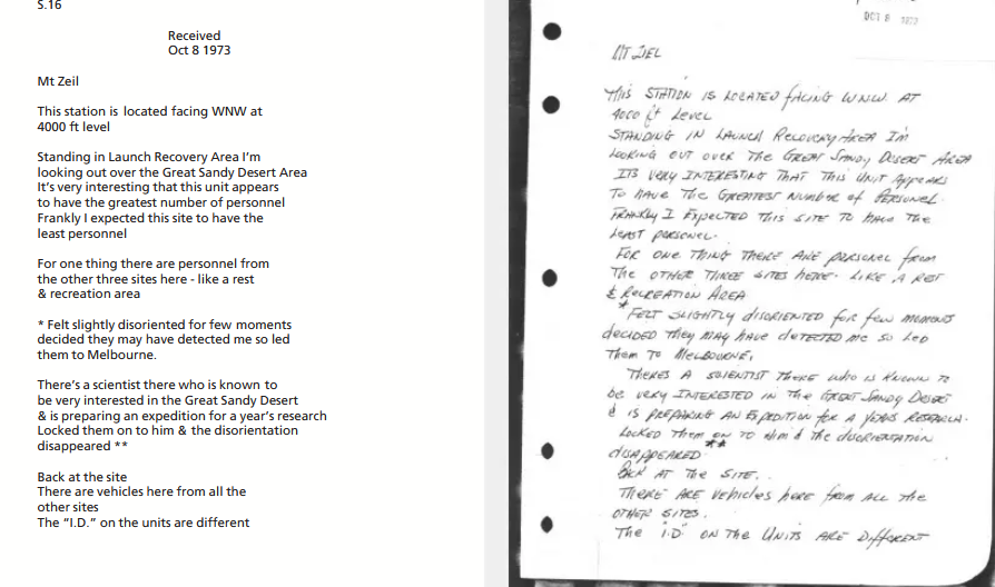
Mount Zeil stood apart. Price called it the ‘Personnel Center’. His notes say it held ‘Personnel for all bases’ and describe it as a ‘Homo Sap intro point’. In plain English, Australia was not the workshop or the lookout. It was the front door. [1, 6]
Price saw more personnel there than at the other sites, along with vehicles carrying different identification marks. People or beings arrived from the other three bases. Some appeared to be resting. Flight orders were controlled from the site. He also wrote that Mount Zeil had better ‘theta detection’ and that the area was under alert. [1, 6]
For a moment, Price believed something inside had noticed him. According to a later account, he broke contact and mentally led the watchers towards Melbourne before slipping back to the mountain. Whether that was psychic counter-surveillance, imagination or something else entirely, it is an astonishing detail to find in a document from 1973. [6]
The stranger details continued. Price described inhabitants who looked human on the outside but differed in their hearts, lungs, blood and eyes. He believed they could influence human movement through thought. He referred to ‘B.T.L. implants’, an abbreviation that later project leader Skip Atwater said he could not explain. [1, 6]
1982 / SKIP ATWATER
Project 8200 opens the envelope
Price’s mountain network might have remained one man’s extraordinary private vision. Instead, in 1982, Army intelligence officer F. Holmes ‘Skip’ Atwater decided to revisit it.
Atwater built target folders from Price’s transcripts and information supplied by Puthoff. The viewers were not told they were looking for alien bases—or even mountains. Atwater, however, knew the target and the story behind it. On the public record, Project 8200 was therefore viewer-blind, or single-blind, not double-blind. That leaves a possible route for inadvertent cueing, although it does not prove cueing occurred. [2–3]
It was an internal challenge rather than an official intelligence operation, and Atwater says it never travelled up the chain of command. That may explain why a story involving four alleged non-human installations could exist inside a military remote-viewing unit and still remain almost unknown outside it. [2] The surviving recordings begin in late July 1982. Joseph McMoneagle’s Mount Zeil session is dated 3 August—not 8 October, as some later retellings state—and the public audio runs for about nineteen minutes. [2–3]
The black doorway
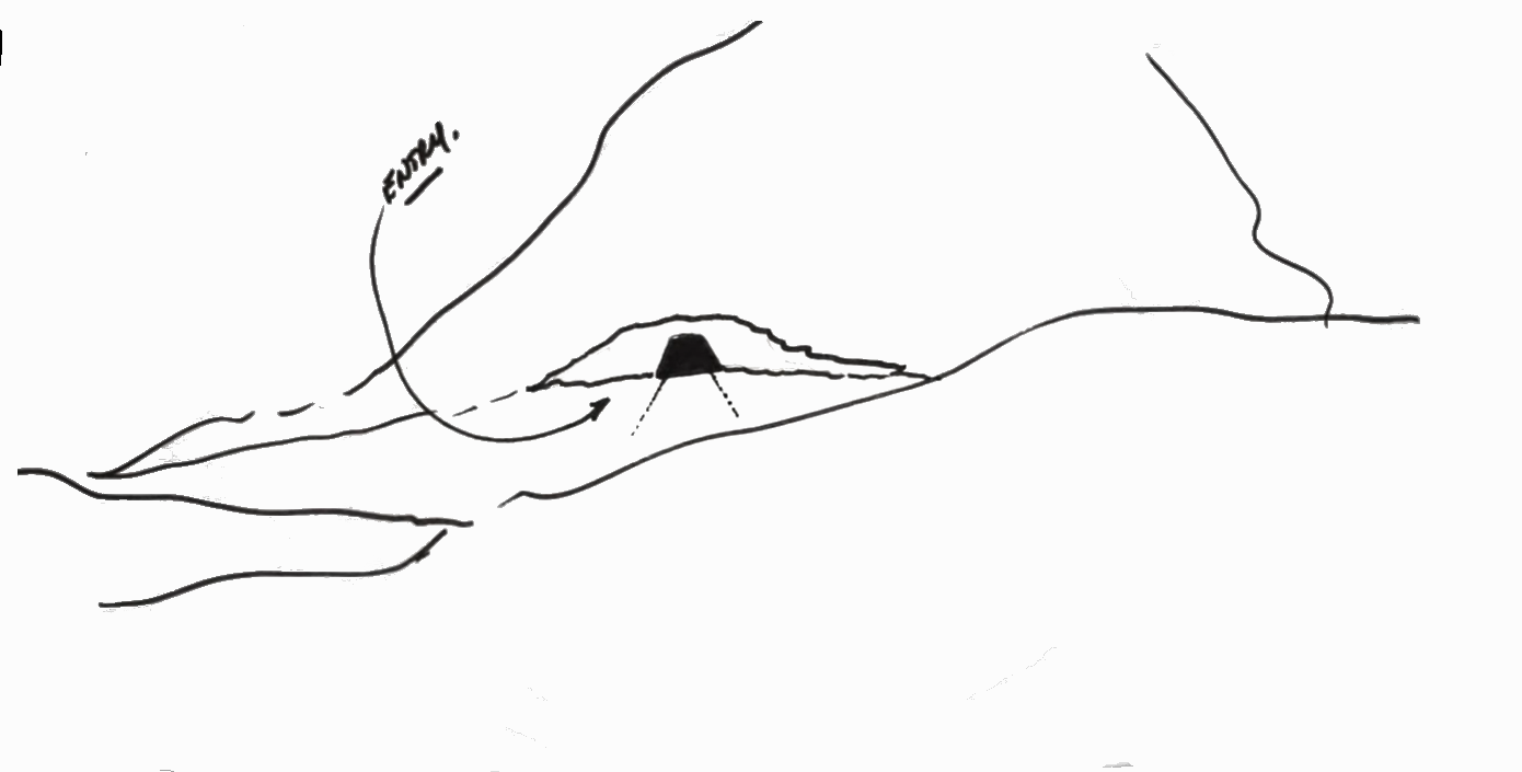
McMoneagle described an underground target, an entry or cave, storage, coils, electronics and something resembling a command or control centre. He mentioned a white dish-like structure, pulsing equipment and a defensive or sinister quality, with only a few people or caretakers present. [2–3]
The famous black doorway is real as a drawing: McMoneagle sketched a dark, filled-in opening and labelled the route ‘entry’. Later retellings turned one feature into the image that now haunts the Mount Zeil story: a huge black doorway opening into the mountain.
Price described a busy personnel centre. McMoneagle, years later and blind to the target name, described a guarded underground technical site. This convergence is the reason Project 8200 refuses to disappear.
 PROJECT 8200: 07-mcmonagle-black-entry.png
LATER VIEWER / BLIND TASKING
Lyn Buchanan arrives
Former Army remote viewer Lyn Buchanan is frequently misidentified as part of the original Project 8200 lineup. Buchanan clarified the timeline himself in a May 2026 interview: "Project 8200 was before I got there". However, project lead Skip Atwater continued to assign the four coordinates blind to incoming viewers, tasking Buchanan with the locations years later. Buchanan later said that, while blind to the target’s identity, he produced descriptions that closely matched Price’s original dossier.
At Mount Zeil, Buchanan perceived an operational underground facility split into two distinct tiers: an upper level managing arrivals and passenger docking, and a lower level dedicated to craft maintenance. Describing the mountain as an entry hub for non-human visitors, he reported observing a "gray female with a baby gray". [4]
It remains one of the most surreal depictions in the public remote-viewing record: beneath the highest peak in Central Australia, an interplanetary transit terminal where families pass through while maintenance crews work below. In Buchanan’s later account of Atwater’s informal investigation, his session provided a third matching layer, turning Price’s rogue 1973 notes into a recurring motif within the unit.
CIA-ADJACENT CLAIM / 2025
When Hal Puthoff took Mount Zeil to Joe Rogan
For decades, the Mount Zeil phone-call story circulated mainly through conference talks, remote-viewing circles and second-hand summaries. In May 2025, Hal Puthoff carried it onto one of the world’s largest podcasts.
Speaking on The Joe Rogan Experience #2314, Puthoff described what allegedly happened after Pat Price told SRI that he had located a UFO base beneath Mount Zeil. Puthoff reported Price’s findings to his CIA contract monitor, who said that he knew a CIA “station keeper” in Australia and would ask him about the area.
The importance of what followed lies in what the Australian contact was not told. According to Puthoff, the contract monitor deliberately withheld Price’s UFO claim and asked only about the Mount Zeil area. The station keeper allegedly responded: “Oh, you mean where the UFOs are always flying around.” [5, 32]
If Puthoff’s recollection is accurate, this was not simply another person repeating Price’s story. The Australian contact introduced the UFO connection independently, without first being told why Mount Zeil was being discussed. It would mean that a claim originating with a remote viewer in California unexpectedly overlapped with information already familiar to a CIA contact in Australia.
Additionally, the call is also important because it suggests Price’s account prompted a real-world intelligence enquiry. Someone connected to the CIA apparently considered the information interesting enough to contact an officer on the other side of the world and received an answer striking enough for Puthoff to remember and repeat decades later.
However, the public trail ends with Puthoff’s account. He did not name the station keeper, identify where in Australia that person was based or say whether the call was documented. A 1974 photograph taken after an SRI glider experiment identifies CIA scientist Christopher ‘Kit’ Green beside Puthoff, Russell Targ and Price, and labels Green as the CIA contract monitor. That makes Green, in our view, a strong candidate for the role Puthoff recalled, although it does not establish that he placed this particular call. [44]
No memorandum, telephone log or written reply has yet surfaced. That absence does not erase the account; it defines the next question. Who was the Australian station keeper, what had already been reported around Mount Zeil, and does any surviving intelligence record preserve the conversation?
For Puthoff, the exchange mattered. He ended the story by naming Price and stating simply: “I take him seriously.”
 AUSTRALIA AFTER DARK: 08-min-min-light.jpg
THE WIDER AUSTRALIAN RECORD
Australia after dark
The Mount Zeil claim did not land in a country without strange lights. Australia’s interior has been collecting them for generations.
The lights that follow travellers
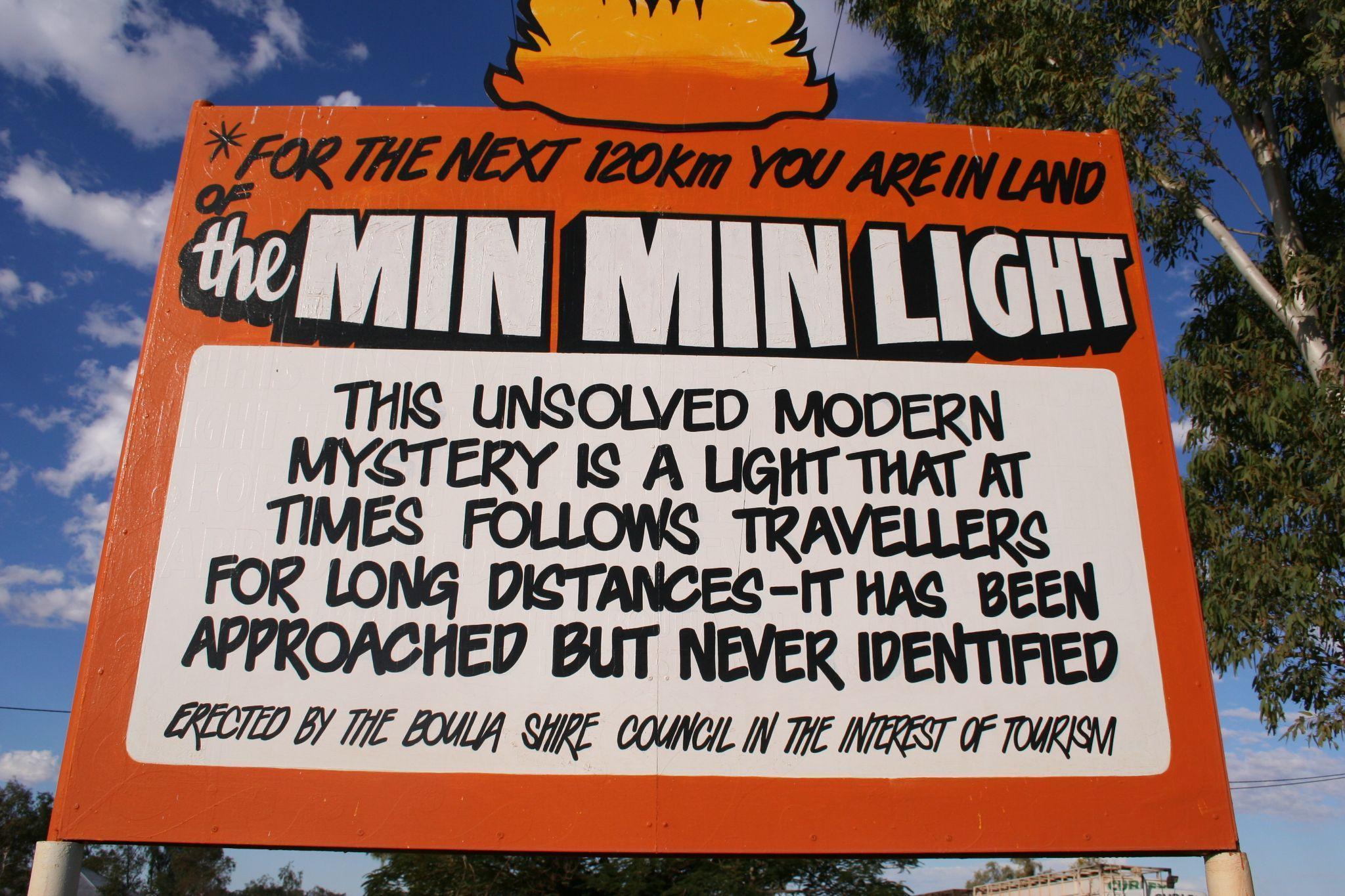
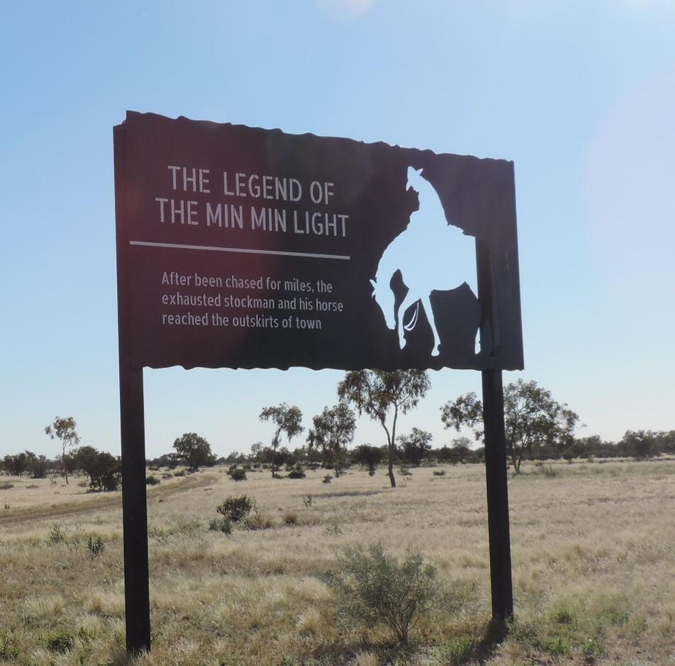
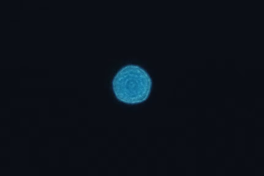
Drive long enough through the outback at night and somebody will eventually warn you about the Min Min lights. They appear low over the horizon: white, blue, yellow or sometimes changing colour. They keep pace with cars. They retreat when approached, return after vanishing and occasionally seem to stalk the traveller who has noticed them. [22–24]
Aboriginal communities knew of mysterious travelling lights before Europeans entered the interior. In parts of the Kimberley they are understood as old people’s spirits watching Country; travellers are warned that the lights can draw a person away from the path. The best-known European story gave the phenomenon its modern name after a stockman reported a light near the old Min Min Hotel in Queensland in the early twentieth century. [24]
There is a strong scientific explanation. University of Queensland researcher John Pettigrew reproduced Min Min-like effects through a Fata Morgana: a temperature inversion bends the light of a distant vehicle or fire over the horizon, delivering it to an observer tens or even hundreds of kilometres away. With no landmarks for scale, the light seems to float, follow and flee. [22–23]
That may account for many sightings. But it does not erase the experience of people who describe lights approaching at close range, changing direction or behaving in ways a distant headlamp should not.
The government files
Mount Zeil’s intelligence files did not occur in isolation; they followed decades of recorded military encounters across Australian airspace. For decades the Royal Australian Air Force collected reports of unusual aerial sightings. The motive was national security, not public curiosity: during the Cold War, an unidentified object might be a satellite, missile, aircraft or debris from somebody else’s space programme. When the RAAF stopped investigating in 1994, it said roughly three per cent of reports remained unexplained. [11]
Some were difficult to wave away. In 1954, a Sea Fury pilot returning to the naval air station at Nowra saw two fast-moving objects while ground radar registered returns. In 1960, personnel at the Wewak weapons-testing site near Maralinga reported a brilliant object. The official file considered a meteor and static effects, then admitted it could not identify the source. [11–12]
The school that looked up
On 6 April 1966, a clear autumn morning in Melbourne, scores of students and teachers at Westall High School and the neighbouring primary school watched one or more silver disc-shaped objects moving above the city’s south-east. Witnesses described zigzagging flight, sudden acceleration and a controlled descent towards scrubland known as the Grange. Students vaulted the fence and ran after it. Several later recalled a swirled circle of flattened or yellowed grass where the object had hovered. [28]
Within about half an hour, witnesses say uniformed men had reached the area. At a later assembly, the school principal told students there were no such things as flying saucers and ordered them not to discuss what they had seen. Some pupils later recalled being questioned separately by unfamiliar men who suggested a weather balloon; science teacher Andrew Greenwood said he was threatened with prosecution and the loss of his job if he continued speaking. Researcher Shane Ryan has since spoken with 142 people who saw objects in the sky and 197 who saw the ground marks. In October 2025, an 831-signature petition calling for an independent inquiry was formally presented to Parliament. On the sixtieth anniversary in April 2026, surviving witnesses asked again. As this article goes to publication, the parliamentary record shows the petition was presented; it does not record a ministerial response or inquiry. [28, 48‑49]
At North West Cape on 25 October 1973, the same year Price produced his mountain dossier, the deputy commander and fire captain at the US-Australian naval communications station separately reported an unusual object near the facility. Researcher Bill Chalker says the sighting occurred on the day the base issued a full nuclear alert to American forces across the Indian Ocean and Pacific. Yet when he inspected the RAAF files in 1982, the case was missing. [13–14]
The pilot who vanished
On 21 October 1978, twenty-year-old pilot Frederick Valentich was flying a Cessna 182 over Bass Strait when he asked Melbourne Flight Service whether any other aircraft were in the area. Told there was no known traffic, he described a large object passing above him, circling and apparently playing a game with his aircraft. His final transmission reported: ‘That strange aircraft is hovering on top of me again … and it’s not an aircraft.’ Then came an unexplained metallic sound. Valentich and the Cessna disappeared. A four-day search found no wreckage, and a later coronial inquiry returned an open verdict. Australia was left not merely with a sighting, but with a missing pilot and a recorded final conversation. [29]
Taken together, these cases establish something important: unusual objects around Australian schools, aircraft, weapons ranges and defence facilities were reported inside official systems, not merely at tourist stops or UFO meetings. The records do not all point to the same explanation, but they show a repeated institutional pattern: reports were collected, witnesses were questioned, files were opened, and some events remained unresolved. Mount Zeil belongs within that larger unfinished history.
 COMPARISON: 09-min-min-comparison-a.jpg
 COMPARISON: 10-min-min-comparison-b.png
WYCLIFFE WELL / KARLU KARLU
Wycliffe Well keeps a photograph
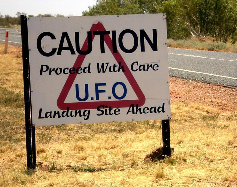
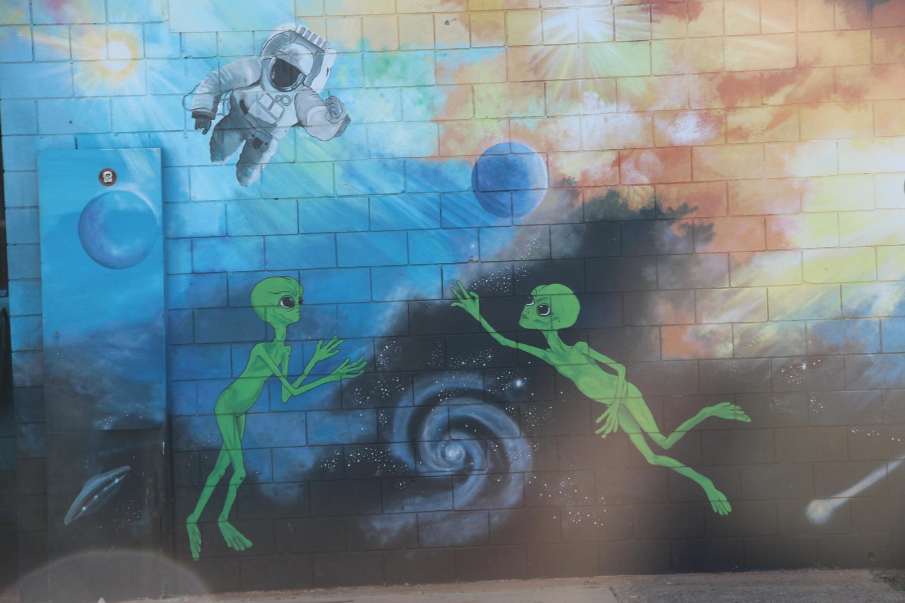
North of Alice Springs, the tiny Stuart Highway stop of Wycliffe Well eventually turned its UFO reputation into a roadside attraction. Alien murals, sighting logs and night-time sky watches made it Australia’s unofficial UFO capital. Before the flood damage of 2022 closed the old roadhouse, owner Lew Farkas collected years of reports from travellers. [15–16]
But the story people should be chasing is older.
During the Second World War, Army transport driver Viv Martin reportedly encountered one or more unusual silver objects near Karlu Karlu / Devils Marbles. In Phil Martin’s later account, soldiers raced after the objects until tree roots shredded their tyres; they searched for hours and found nothing. [15]
Here the published trail forks. Australian Geographic’s 2025 account says Viv Martin saw a small silver craft, while his son Phil described two objects the size of football fields; it adds that the craft had vanished by the time Viv reached a hill to take a photograph. A 2010 published account, later examined by researcher Keith Basterfield, instead says a print on the Wycliffe Well roadhouse wall showed soldiers with a small silver craft clearly in the frame. Both versions cannot describe the same photograph exactly as written. [15, 45]
Unfortunately, the alleged photograph has not been located in the public record. Whether it was lost during past renovations, damaged by the elements, or removed from display, the original print remains unverified. Until the original print resurfaces, the truth remains somewhere beyond our reach.
 WYCLIFFE WELL: 11-wycliffe-well-a.jpg
 WYCLIFFE WELL: 12-wycliffe-well-b.jpg
GLEN HELEN GORGE / 2020
The caterpillar in the photograph
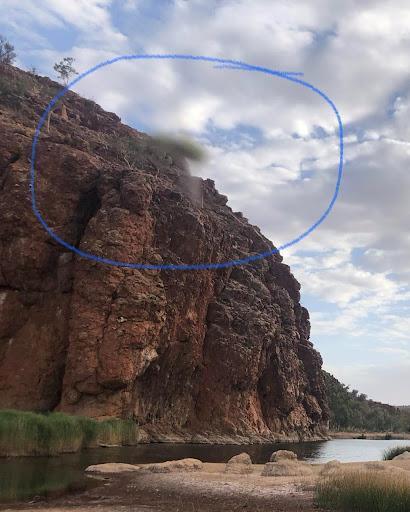
In 2020, Philip Jamieson and Marianne Schmidt published a photograph taken at Glen Helen Gorge. Above the ridge hangs an elongated blur, green-grey and oddly organic. Schmidt had not intended to photograph it. To her, it resembled a caterpillar. [9]
The pair connected the image with the Caterpillar Dreaming they were exploring across the Arrernte landscape. Glen Helen Gorge is not Mount Zeil, and a blur is not a creature simply because it looks like one. But in a country shaped by travelling caterpillar beings, whatever crossed the frame creates an unexpected echo between a modern visual anomaly and the much older story carried by the landscape.
 VISUAL ANOMALY: 13-caterpillar-blur.jpg
SATELLITE / AERIAL / COORDINATE TEST
Google Earth finds a dark patch
Once Price, McMoneagle and Buchanan had supplied the underground base, online investigators went looking for a door. Michael Organ’s marked feature on the western flank gave us a testable point: 23.3812686°S, 132.3189971°E. [17]
In online imagery he identified a dark section unlike the surrounding terrain, an area that appears quarried, what may be an east-west track and a blurred patch close to the place he wondered might conceal an entrance. [17]
Then the old remote-viewing description returned: McMoneagle’s black doorway.
Online satellite imagery is not a transparent window onto the ground. It is assembled from different sensors, dates, resolutions and processing choices; sensitive locations elsewhere in the world have sometimes been blurred or restricted. The darkened ground, apparent disturbance, possible track and blurred area are specific enough to compare across independent images and different years.
That turns speculation into a genuine line of inquiry.
The first result is a map problem. Organ’s feature is about 8.2 kilometres west of the Northern Territory’s registered summit. It is also about 15.6 kilometres from Price’s printed / Project 8200 point and 46.4 kilometres from Price’s handwritten point. The black patch, the official peak and the two Price coordinates are four different places. That does not decide what is under the mountain, but it prevents one pixel from being casually called ‘the target’. [1, 17, 36]
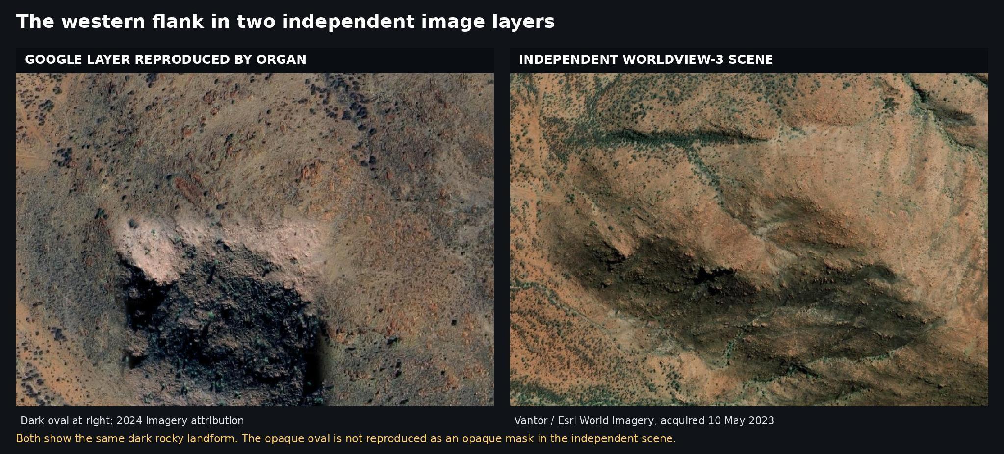
We next compared the marked Google view with an independent 31-centimetre WorldView-3 scene acquired on 10 May 2023 and served through Esri’s Vantor imagery layer. The same dark rocky or vegetated landform is present. The opaque black oval or blurred ‘door’ is not reproduced. At that resolution we found no obvious quarry benches, cut faces, spoil piles, straight engineered road or visible portal. The east–west line appears to branch with natural drainage, shadow and vegetation. [17, 41]
That result argues against this particular blur being proof of deliberate Google censorship; it does not test an underground chamber. The independent scene still shows a striking dark landform, and natural-looking surface geometry cannot tell us what lies beneath it.
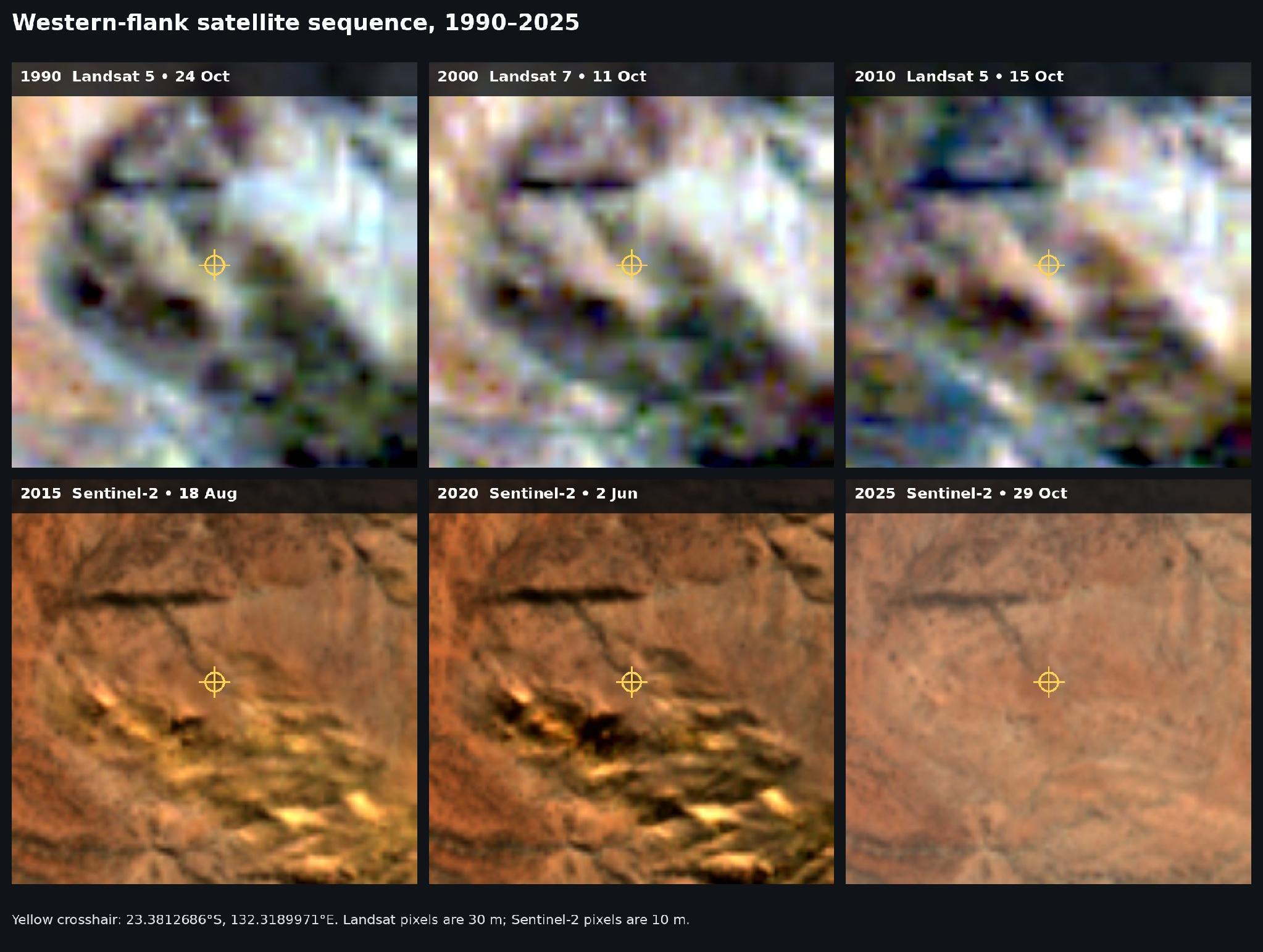
We also pulled cloud-light scenes for the same point from Landsat 5 (1990 and 2010), Landsat 7 (2000) and Sentinel-2 (2015, 2020 and 2025). Across thirty-five years, the broad dark form and drainage pattern persist. No large new excavation appears at the 30-metre Landsat or 10-metre Sentinel scale. The older satellite images are too coarse to reveal a doorway or determine exactly what the feature is. They do, however, show a mark in the same position in imagery captured at different times. Meaning it’s less likely to be a glitch confined to one Google image. The available evidence suggests that something persistent is visible at that location, even if the images cannot tell us what it is. [39–40]
The photograph taken before Price
A photograph from before Price’s report reached SRI
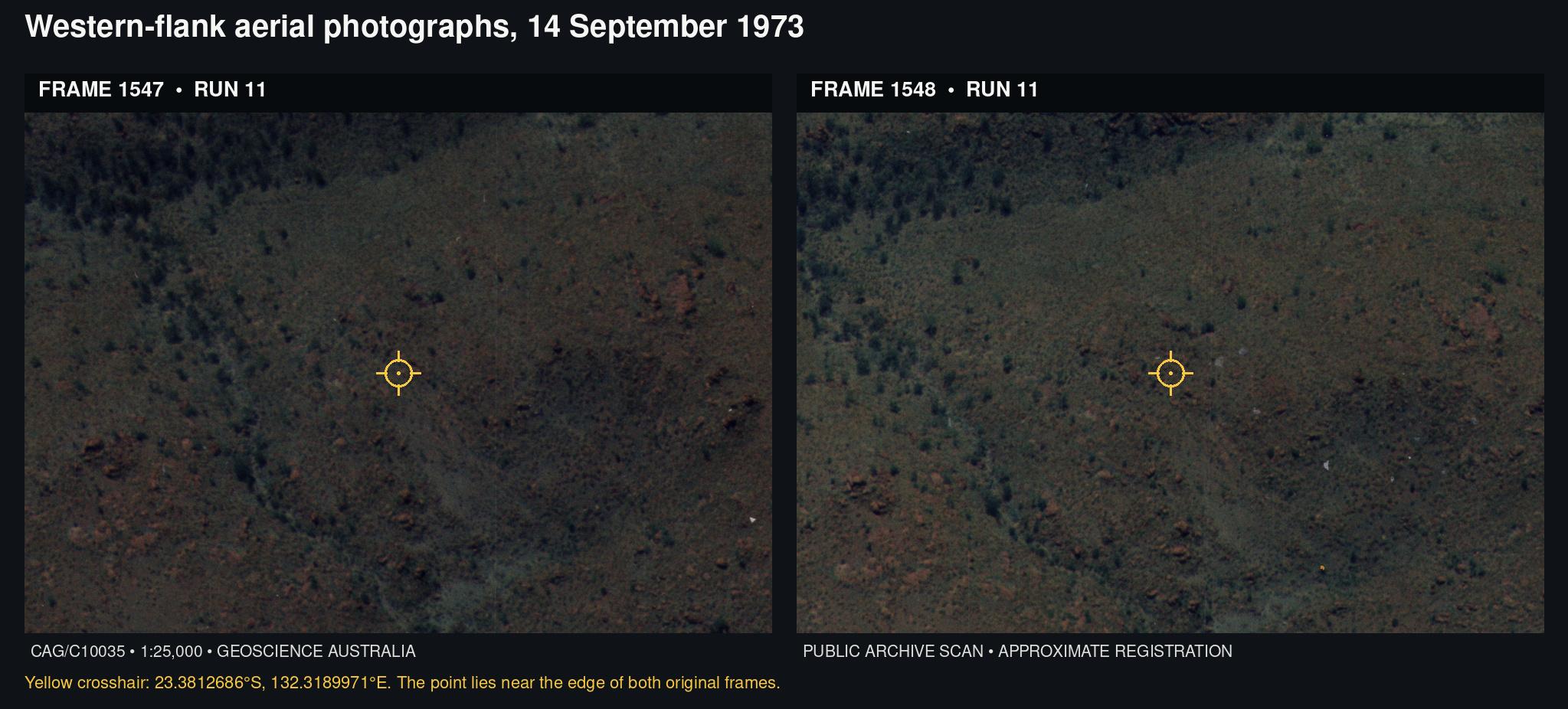
Geoscience Australia’s historical aerial-photography catalogue produced a more useful result than the satellite record. The nearest identified coverage includes military-mapping frame SVY844 run 6 frame 5034 from 21 April 1950; CAG7009 run 4 frame 045 from 3 July 1971; CAG/C10024 run 10 frames 780–781 from 28 August 1973; CAG/C10035 run 11 frames 1547–1548 from 14 September 1973; a 1974 ‘Special Project Photography’ run over Glen Helen and Narwietooma; and a 1986 survey frame. [37–38]
The two September 1973 frames were photographed 24 days before SRI received Price’s Mount Zeil page. Both public previews and the full-resolution scans are accessible. When the overlapping photographs are registered against modern imagery, Organ’s marked coordinate falls close to the edge of each frame. Both show the same natural-looking rock, vegetation and drainage pattern. Neither reveals an obvious quarry, engineered entrance or the opaque oval visible in one Google image.
That does not test what may lie underground, and the old aerial photographs are not survey-grade orthophotos. But they move the visible surface record back to 14 September 1973—before the surviving dated Price sequence begins. Whatever produced the darker surface feature, it was already part of the landscape before Price’s Mount Zeil report reached SRI. [1, 37–38]
 COORDINATE TEST: 14-mount-zeil-coordinate-comparison.png
 INDEPENDENT IMAGERY: 15-google-vantor-comparison.jpg
 TIME SERIES: 16-satellite-sequence-1990-2025.jpg
 HISTORICAL AERIAL: 17-september-1973-aerial-comparison.jpg
The surface verdict: a darker landform already visible in September 1973, not a demonstrated quarry or censored entrance. The archival verdict: the relevant scans are public and show no obvious engineered surface works at the mapped point. The underground verdict remains open: aerial photographs cannot tell us what lies beneath the mountain.
Price’s present and what came later
Price’s surviving papers present the installations as contemporary: his descriptions use the present tense, and his function sheet refers to what is happening ‘right now’, not to an ancient or future installation. That cannot establish what a psychic experience represented, but it removes an easy escape hatch: anyone reassigning the sessions to another era needs a later source for that interpretation. [1]
The story widened after Atwater began discussing Project 8200 publicly in the late 1990s. One later account, repeated by Robert O. Dean and Wendelle Stevens, describes an anonymous retired colonel being teleported from Nevada’s S-4 to an extraterrestrial installation ‘a mile and a half’ from Pine Gap. Organ links that story to Mount Zeil, but the literal geography does not: Mount Zeil is roughly 140 kilometres west of Pine Gap. If both tales are retained, they describe different alleged sites unless ‘a mile and a half’ was wrong or the journey was not geographical in the ordinary sense. [17, 30, 36]
By the 2000s, material attributed to self-described intelligence insider James Casbolt recast Mount Zeil as Pine Gap’s twin and an ‘Anunnaki stronghold’, adding Draco Reptilians, human military involvement and an approaching conflict. The 2021 ‘Earth Alliance’ evacuation entered through the contactee and exopolitics reporting of Elena Danaan and Michael Salla about alleged Jupiter agreements; Organ’s compilation then connected that wider cosmology to Mount Zeil. [17, 33, 46]
This is how the layers link. Price supplied the four-mountain network and the Australian ‘introduction point’. Project 8200 supplied later underground descriptions and sketches. Puthoff’s phone story added a CIA-adjacent claim of local UFO knowledge. Casbolt and the contactee tradition supplied the factions, alliance and conflict. The continuity is real as a chain of stories and claimants; it is not one uninterrupted declassified record. If the 2021 account is accepted on its own terms, a quiet mountain today would mean the story had moved on. [1–5, 17, 33, 46]
Where the map runs out
The western feature is not confined to Google. The broader rock, vegetation and drainage pattern appears in independent 2023 imagery, lower-resolution satellite scenes back to 1990 and now two overlapping aerial photographs taken on 14 September 1973. The older frames do not reproduce the opaque oval, nor do they reveal an obvious quarry, engineered road or portal at Organ’s marked point. They cannot tell us what lies underground. Price’s two coordinate sets also miss each other by about 45 kilometres; neither identifies Organ’s pixel. [1, 17, 36–41]
McMoneagle really did draw a black entry, but the source does not call it gigantic. Puthoff really did tell Joe Rogan the CIA-station story, but the public archive still supplies no call record or identified Australian station keeper.
Geoscience Australia’s public scans of frames 1547 and 1548 were photographed before the surviving dated Price sequence begins and 24 days before SRI received his Mount Zeil page. Both show the same natural-looking surface pattern around the mapped coordinate, without obvious engineered works. The 1950 film remains unscanned. Phil Martin’s Wycliffe Well photograph is still reported to exist, but published descriptions disagree about what it shows. And we found no publicly documented ground or geophysical survey specifically testing the claimed Mount Zeil target area. [1, 15, 37–38, 45]
We have. The historical photographs strengthen the evidence for a persistent surface feature while weakening the narrower claim that the Google oval proves recent excavation or deliberate censorship. What remains untested is the claim beneath the surface and why the archival evidence, witness accounts and physical site have not been examined together in any public investigation.
So where does that leave us? Four competing locations. Two 1973 aerial photographs that clarify the surface but cannot see below it. One missing Wycliffe Well photograph. An unverified phone call. And no authorised survey of the place the claim actually points to.
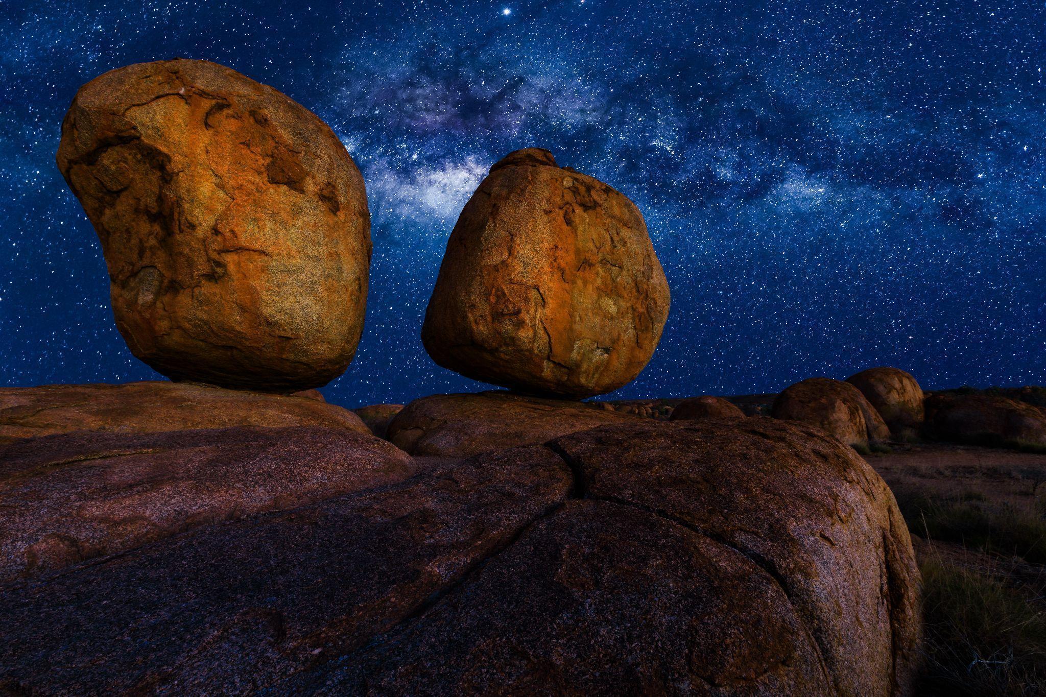 FIELD ROUTE: 18-devils-marbles-night.jpg
49 SOURCES / CHECKED 18 AUGUST 2026
Research trail
This source trail was checked and updated on 18 August 2026.
01 Participant document / facsimile +
1. Participant document / facsimile — The Pat Price Remote Viewing Papers. Daz Smith’s reproduction and transcription of Price material; privately released, not a declassified CIA conclusion about Mount Zeil.
02 Participant archive +
2. Participant archive — Skip Atwater: Project 8200. Atwater’s project history, session summaries, transcripts and the surviving Joseph McMoneagle recording dated 3 August 1982.
03 Public recording archive +
3. Public recording archive — Remote Viewing Project 8200 recordings. Monroe Institute upload of the surviving dated 1982 recordings. The public Atwater/McMoneagle Mount Zeil audio runs for approximately 18 minutes 47 seconds. The Archive item page displays inconsistent 32:47 metadata, but the downloadable video itself runs for approximately 18:47.
04 Participant interview +
4. Participant interview — Lyn Buchanan on American Alchemy. May 2026 transcript containing Buchanan’s chronology correction and later public account of the Mount Zeil sessions, underground levels, docking area and alleged entities.
05 Primary participant interview / official video +
5. Primary participant interview / official video — The Joe Rogan Experience #2314: Hal Puthoff. Published 1 May 2025. The broader lead-in to Puthoff’s alleged Australian CIA station-keeper account begins at approximately 1:19:31; Mount Zeil is first named at approximately 1:20:04, and the account ends at approximately 1:20:44.
06 Secondary interview / early compilation +
6. Secondary interview / early compilation — Cassandra Frost: Remote Viewing Underground Bases. A 2005 account preserving Price and Atwater details, including the Melbourne diversion and alleged station-keeper telephone call. It is a secondary retelling rather than a surviving call record.
07 Local-government cultural history +
7. Local-government cultural history — Town of Alice Springs: A Brief History. Public account of Arrernte custodianship, caterpillar ancestors and links to Urlatherrke.
08 Public cultural resource +
8. Public cultural resource — Araluen Arts Centre: The Yeperenye Sculpture. Public description of caterpillar groups converging on Mparntwe, including Urlatherrke in the west.
09 Author-published photograph and interpretation +
9. Author-published photograph and interpretation — Jamieson and Schmidt: Central Australia’s Caterpillar Dreaming. Source of the Glen Helen Gorge photograph and the authors’ interpretation.
10 Declassified programme history / archived CIA document +
10. Declassified programme history / archived CIA document — The Grill Flame Scientific Evaluation Committee, CIA-RDP96-00788R001300120001-5. A public copy of the declassified document formerly hosted by the CIA Reading Room. The retrospective programme account credits Price with identifying a sensitive West Virginia installation and producing classified code words.
11 Government archive guide +
11. Government archive guide — National Archives of Australia: Flying saucers—fact or fiction?. Official overview of RAAF reporting, its Cold War context and the 1954 Sea Fury case.
12 Government archival case +
12. Government archival case — National Archives of Australia: UFO sightings at weapons-testing site, Woomera. Official resource based on the 1960 Wewak/Maralinga report.
13 Journalism / archival investigation +
13. Journalism / archival investigation — ABC: Accessing Australia’s secret UFO files. Bill Chalker’s research and the reported gap in the North West Cape files.
14 Independent case research +
14. Independent case research — Keith Basterfield: North West Cape, 25 October 1973. Witness material and consideration of a possible bird-flock explanation.
15 Journalism / oral-history reporting +
15. Journalism / oral-history reporting — Australian Geographic: Wycliffe Well—Australia’s outback UFO hotspot. Source for the Viv and Phil Martin account, including the reported small silver craft, the two football-field-sized objects and the claim that the craft had vanished before Viv could photograph it.
16 Regional journalism +
16. Regional journalism — ABC: Inside Wycliffe Well, Australia’s UFO capital. Roadhouse history, the Farkas sighting ledger and the site’s condition after the 2022 flood.
17 Independent evolving compilation +
17. Independent evolving compilation — Michael Organ: Alien base @ Urlatherrke/Mount Zeil, Australia. Updated 8 July 2026; source for the western-flank imagery question, the stated Google coordinate, Casbolt material and the later 2021 Earth Alliance cosmology. It is an evolving independent compilation rather than an official investigation.
18 Land-access authority / contextual reference +
18. Land-access authority / contextual reference — Central Land Council: Permits. Current guidance concerning permits and access to Aboriginal land in the Central Land Council region. Retained as context for the practical and legal limitations surrounding any proposed ground investigation.
19 Government access guidance / contextual reference +
19. Government access guidance / contextual reference — Northern Territory Government: Land permits. Official permit framework and access information relevant to any proposed field investigation on Aboriginal land.
20 Declassified government programme review / archived CIA document +
20. Declassified government programme review / archived CIA document — An Evaluation of the Remote Viewing Program: Research and Operational Applications, CIA-RDP96-00791R000200180005-5. Public copy of the 1995 draft institutional review formerly hosted by the CIA Reading Room. It provides programme history and context but is not a Mount Zeil assessment.
21 Government geospatial reference +
21. Government geospatial reference — Geoscience Australia: Highest Mountains. Lists Mount Zeil at 1,531 metres as the Northern Territory’s highest mountain.
22 Peer-reviewed research +
22. Peer-reviewed research — Pettigrew: The Min Min light and the Fata Morgana. A 2003 optical account based on observation and field demonstration.
23 University research summary +
23. University research summary — University of Queensland: Scientist unlocks secret of Min Min lights. Accessible explanation of Pettigrew’s temperature-inversion model.
24 Journalism, historical account and Indigenous testimony +
24. Journalism, historical account and Indigenous testimony — ABC: The mysterious phenomenon of Min Min lights provides witness descriptions and Balanggarra ranger James Birch’s account of cultural meaning in the Kimberley. Published accounts differ over the date attached to the best-known Boulia stockman story: the Royal Historical Society of Queensland gives 1918, while Boulia Shire Council’s Min Min Hotel history places the famous account around 1912. The precise date should therefore be treated as disputed.
25 Tourism and current operating information +
25. Tourism and current operating information — Northern Territory: Devils Marbles Hotel confirms accommodation, caravan sites, food and refreshments near Karlu Karlu. Tourism Central Australia/Barkly: Devils Marbles Hotel provides the current stated opening hours of 6 a.m.–10 p.m., seven days a week.
26 Government visitor information +
26. Government visitor information — Karlu Karlu/Devils Marbles Conservation Reserve. Current park status, safety information and advance camping requirements.
27 Declassified technical analysis / archived CIA document +
27. Declassified technical analysis / archived CIA document — An Analysis of a Remote-Viewing Experiment of URDF-3, CIA-RDP96-00791R000200240001-0. Public copy of the technical analysis formerly hosted by the CIA Reading Room. It records Price’s rail-mounted gantry-crane description while judging the experiment unsuccessful overall.
28 Journalism / extensive witness interviews +
28. Journalism / extensive witness interviews — ABC Australian Story: The Westall UFO Mystery at 60. Sixtieth-anniversary investigation containing named witnesses, competing explanations, Shane Ryan’s interview totals and renewed calls for a government response.
29 Official aviation investigation and journalism +
29. Official aviation investigation and journalism — Australian Transport Safety Bureau: Disappearance of Cessna 182L VH-DSJ provides the official occurrence record and links to the 1982 summary report, which states that an intensive air, sea and land search continued until 25 October 1978 without finding the aircraft and that the reason for its disappearance was not determined. ABC: The disappearance of Frederick Valentich examines his final recorded transmission. ABC: How the disappearance of Frederick Valentich inspired The Kettering Incident records the 1982 coronial inquiry’s open verdict.
30 Government and historical sources +
30. Government and historical sources — Australian Defence Ministers: Securing Australia’s Sovereignty. Official description of Pine Gap as a jointly operated Australian–United States facility with intelligence and missile-warning functions. Australian War Memorial: Project Rainfall—The secret history of Pine Gap records that the intelligence station was officially called the Joint Defence Space Research Facility despite having no space-research function.
31 Declassified programme record / archived CIA document +
31. Declassified programme record / archived CIA document — Proposed Star Gate Management Strategy, CIA-RDP96-00791R000100150002-0. Public copy of the declassified document formerly hosted by the CIA Reading Room. It identifies the linked programme names SCANATE, Grill Flame, Center Lane, Sun Streak and Star Gate.
32 Searchable transcript / locator +
32. Searchable transcript / locator — JRE.AI: Episode #2314 transcript. The broader lead-in to the alleged station-keeper exchange begins at approximately 1:19:31; Mount Zeil is first named at approximately 1:20:04. The site warns that its transcript is AI-generated, so all wording and timings should be checked against the official video in source 5.
33 Archived contactee / underground-base account +
33. Archived contactee / underground-base account — Alien Underground Bases and Remote Viewing. Archived copy of an account attributed to James Casbolt and the source for the 2000s Anunnaki, Draco and Pine Gap “twin facility” layer. It is a contactee account, not an official intelligence record.
34 Government geology +
34. Government geology — Northern Territory Geological Survey: Geology of the Northern Territory, Aileron Province. Identifies the Mount Zeil Granite as the unit that forms Mount Zeil and describes the surrounding Aileron Province geology.
35 Government/Traditional Owner joint-management plan +
35. Government/Traditional Owner joint-management plan — Tjoritja/West MacDonnell National Park Joint Management Plan. Sets out cultural-information ownership, consultation requirements and the pathway for research proposals. It provides regional governance context rather than evidence for or against the modern Mount Zeil claim.
36 Official place-name record +
36. Official place-name record — Northern Territory Place Names Register: Mount Zeil. Registered summit coordinate used for the distance comparison.
37 Government imagery archive +
37. Government imagery archive — Geoscience Australia: Historical aerial photography. Archive scope, access route and contact information for scanned and film holdings.
38 Government aerial-photography catalogue +
38. Government aerial-photography catalogue — Australian Historical Aerial Photography Explorer. Catalogue records used to identify the Mount Zeil-area frames: SVY844, Run 6, Frame 5034, photographed 21 April 1950 and marked unscanned; CAG7009, Run 4, Frame 045, photographed 3 July 1971; CAG/C10024, Run 10, Frames 780–781, photographed 28 August 1973; CAG/C10035, Run 11, Frames 1547–1548, photographed 14 September 1973; CAG8544, Run 20, including Frame 192, photographed 13 July 1974; and CABG2835, Run 4, including Frame 964, photographed 27 August 1986. The 1971, 1973, 1974 and 1986 records are marked scanned.
39 Government satellite-item records +
39. Government satellite-item records — Digital Earth Australia STAC catalogue records for the comparison scenes acquired on 24 October 1990, item dc110f9a-d284-453a-acec-0e66eebcaa67; 11 October 2000, item be751e92-957f-4e72-903b-0e466d5bdd73; and 15 October 2010, item e2b0ba0d-0179-4817-9f7d-a60529472c24. The USGS Landsat Data Access guide provides the wider mission and data-access context.
40 Earth-observation catalogue records +
40. Earth-observation catalogue records — Digital Earth Australia records the Sentinel-2 acquisition of 18 August 2015, item 590a025d-40c0-4bf5-92c4-c18eac54b799. Earth Search records the Sentinel-2 acquisitions of 2 June 2020, item S2A_52KHV_20200602_1_L2A, and 29 October 2025, item S2B_52KHV_20251029_0_L2A. The Digital Earth Australia STAC access guide explains how individual observation records can be queried and reproduced.
41 Independent commercial satellite imagery +
41. Independent commercial satellite imagery — Esri World Imagery service. Identify metadata at Organ’s stated point returned a Vantor WorldView-3 scene acquired on 10 May 2023 at a listed resolution of approximately 31 centimetres, providing an image source independent of the marked Google layer.
42 Declassified scientific review / contextual reference +
42. Declassified scientific review / contextual reference — Jessica Utts, An Assessment of the Evidence for Psychic Functioning, CIA-RDP96-00791R000200070001-9. Public copy of the favourable assessment commissioned for the 1995 remote-viewing review. Retained as programme-wide context; it is not a Mount Zeil assessment.
43 Declassified collected review / contextual reference +
43. Declassified collected review / contextual reference — An Evaluation of Remote Viewing: Research and Applications, CIA-RDP96-00791R000200180006-4. Public copy of the final review package, including Ray Hyman’s critical response. Retained to represent the disagreement within the formal programme review; it does not evaluate Mount Zeil.
44 Journalism / contemporary photograph +
44. Journalism / contemporary photograph — VICE: A Psychic Spy. A 1974 post-experiment photograph identifies Christopher “Kit” Green with Puthoff, Targ and Price and labels him the CIA contract monitor. It establishes Green’s involvement but does not identify who placed the alleged Mount Zeil telephone call.
45 Independent historical case research +
45. Independent historical case research — Keith Basterfield: A 1942 Australian UFO photograph?. Examines an earlier published description of the Viv Martin/Wycliffe Well photograph, in which soldiers and a small silver craft were reportedly visible, and highlights the photograph’s unresolved provenance.
46 Contactee / exopolitics claim +
46. Contactee / exopolitics claim — Michael Salla: Secret meetings near Jupiter decide the future of our solar system. A 2021 source for the “Earth Alliance” and Jupiter-agreement layer later attached to Mount Zeil; not a government record.
47 Official tourism guide +
47. Official tourism guide — Northern Territory: Tennant Creek destination guide. Current visitor, accommodation and trip-planning information for Tennant Creek and the Barkly region.
48 Official parliamentary petition record +
48. Official parliamentary petition record — Australian Parliament: Petition EN7396. Records the request for an independent inquiry into the Westall incident, 831 signatures and presentation to the House. At the time this trail was checked, the parliamentary record showed no ministerial response.
49 Parliamentary presentation record +
49. Parliamentary presentation record — House of Representatives Petitions Committee: Report No. 3, 27 October 2025. Records the formal presentation of petition EN7396.
Image and media notes from the publish-ready source +
- (Source: Adobe Stock Images, Mt Zeil By FiledIMAGE)
- (Source: Adobe stock images, MacDonnell Ranges, Northern Territory, Australia By Maurizio De Mattei)
- (Image of Pat Price sourced: www.remoteviewed.com/pat-price/)
- (Pat Price’s crane images sourced: www.remoteviewed.com/pat-price/)
- (Francis Wickware, ‘Edyth Hull ESP cards’, Dr. Rhine and ESP, Life, 15 April 1940 / Wikimedia Commons, public domain. Image darkened in Canva.)
- (Source: The Pat Price Remote Viewing Papers facsimile [1].)
- (Kerry Raymond, CC BY 4.0 <https://creativecommons.org/licenses/by/4.0>, via Wikimedia Commons)
- (Image Sources: www.gondwananet.com, CC BY-SA 3.0 <https://creativecommons.org/licenses/by-sa/3.0>, via Wikimedia Commons & https://www.abc.net.au/news/2019-10-20/min-min-lights-make-debut-in-outback-documentary/11607382- A close-up shot of the light Don Meers and his crew captured on film.
- (Flickr user: tm-tm Tallinn, Estonia https://www.flickr.com/people/tm-tm/, CC BY-SA 2.0 <https://creativecommons.org/licenses/by-sa/2.0>, via Wikimedia Commons. 2nd image Source: Wycliffewellvisitor, CC0, via Wikimedia Commons)
- (The unexplained ‘caterpillar’ blur photographed at Glen Helen Gorge and published by Philip Jamieson and Marianne Schmidt in 2020. Source: Central Australia’s Caterpillar Dreaming [9].)
- (Source Adobe Stock: Scenic nocturnal australian outback landscape of Devils Marbles The Eggs by night with milky way, stars field and galaxie. Granite boulders of Karlu Karlu in Northern Territory, Central …By bennymarty)
THE UNKNOWN QUEST
The surface has been tested.
The underground claim has not.
The source record, coordinate discrepancies and historical imagery now give the Mount Zeil story something it rarely had before: specific questions that can be checked rather than endlessly repeated.